

Key Benefits of Using a Web Platform

Detect issues early on
Analyze the health of your crops to make sure they thrive in current conditions and identify early signs of disease or pest infestations
Monitor your fields remotely
24/7 access to a dashboard that gathers data from agri-sensors and satellite imagery. A photo gallery provides a visual history, making it easy to compare fields and different growth stages from wherever you are.

Data-driven decisions
Track changes over time by using the timeline feature, keep digital notes in one place, and get AI-powered recommendations.
Compare fields and seasons
Save notes about different seasons, growth stages, cycle lengths, and any issues you faced to improve your future planting strategies.


Automated BBCH-scale
Monitor the plant development index of each field and track how crops progress through different growth stages. Get information about phenological stages without the need for scouting.
Optimized fertilization
Plan fertilization schedules more efficiently, ensuring that nutrients are applied at the right time for maximum benefit.

Data-driven decisions
Make smarter agricultural decisions with the AI-powered field scoring feature. These scores are meant to make it simpler for you to align your resources and efforts with the needs of your crops.
Paperless notes
Make notes about any of your fields, seasons, crop development milestones, issues, and solutions — Cropler will save it for years.

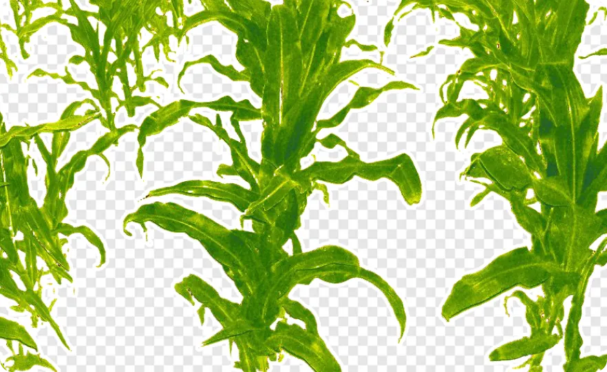
True Plant NDVI: Beyond Background Noise
Our computer vision technology isolates vegetation to remove "noise" from soil, shadows, and crop residues. You get an NDVI that reflects actual plant health, not the environment around it. This provides a level of sub-centimeter detail that satellite imagery simply cannot match, especially when plants are very small.
Precise Biomass Development & Leaf Dynamics
Track the true trajectory of biomass development by monitoring leaf area changes with high precision. Capture exactly how weather patterns and fertilization strategies impact crop growth. By quantifying these dynamics in real-time, you can validate your agronomic decisions with hard data.
High-Resolution Crop Monitoring
Analysis at the leaf level acts as an early warning system. Detect nutrient deficiencies, physiological stress, or disease onset days before they become visible to the human eye. Transition from reactive field management to proactive, targeted interventions.
Soil NDVI: Topsoil Moisture Dynamics
We turn background data into a new revenue stream for information. By separately analyzing the spectral signature of soil, the system tracks topsoil moisture dynamics and detects minor rainfall events. This allows for superior irrigation optimization and more precise field management.


Work in unison with nature
Plan irrigation and fertilization better, look out for diseases that may develop due to specific environmental conditions, and take preventive measures to protect your crops.
All-in-one tool
Always be sure you get local weather data since temperature sensors are installed in the agri-camera.

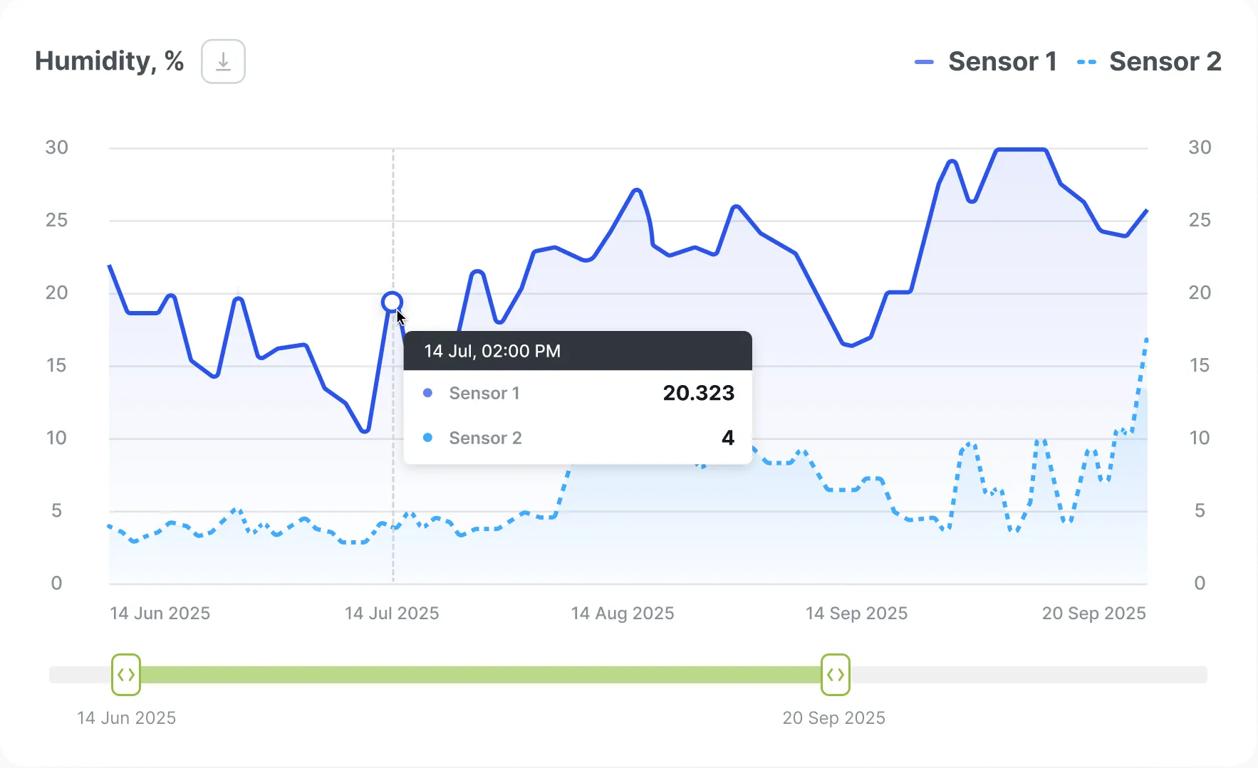
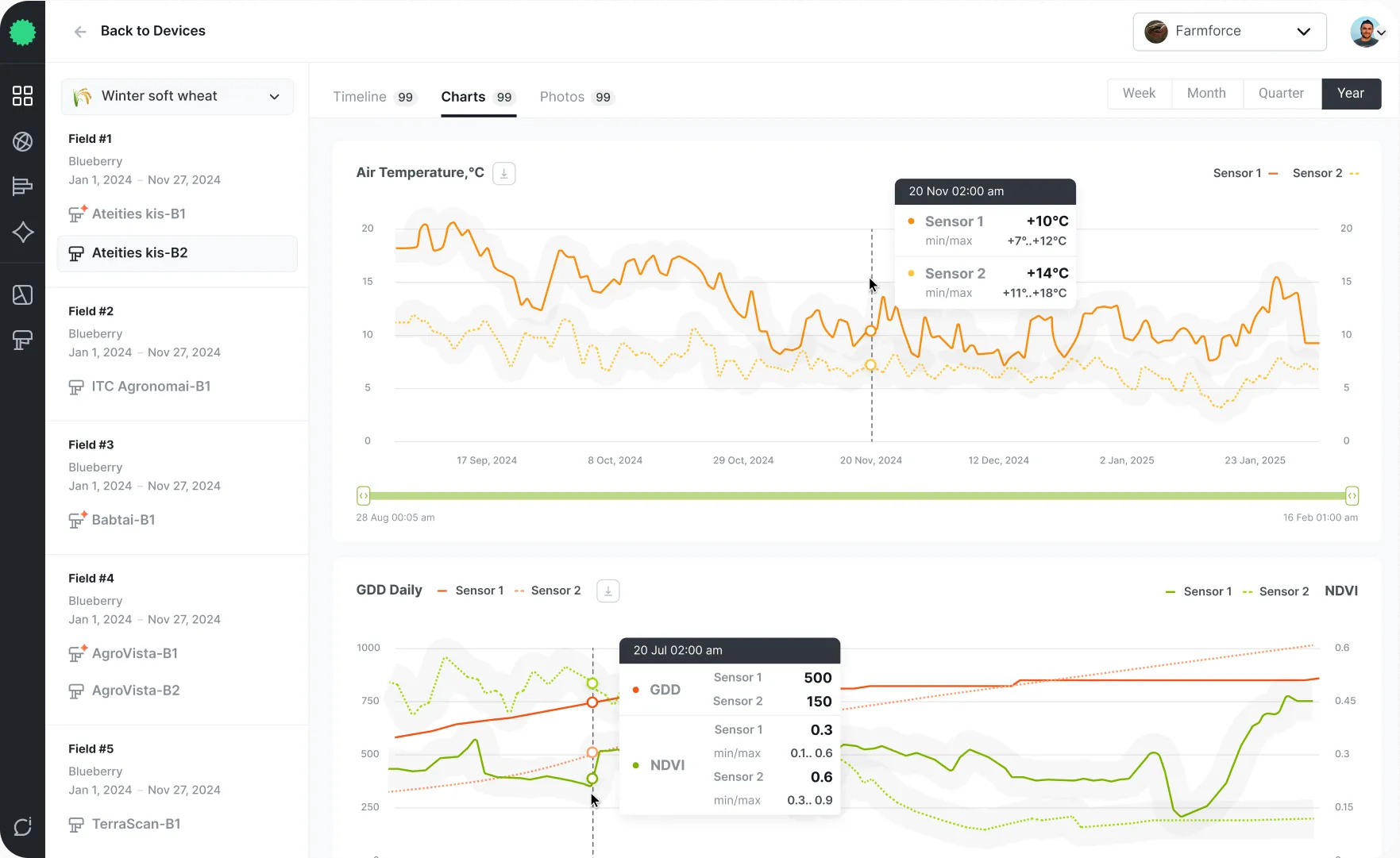
Real-time weather data
Stay ahead of changing weather conditions and make timely, data-based agronomic decisions. Use the dashboard to monitor a variety of aspects, from temperature and atmospheric pressure to humidity and dew point — all in real time.


Advanced remote scouting tool
It helps you monitor crop health, manage field boundaries, and assess plant development. You can create and organize fields while keeping track of seasonal data; if your field boundaries are not predefined or shown incorrectly, you can draw them manually.
Plan operations efficiently
As crops ripen, the NDVI image gradually shifts toward blue, signaling the end of the growth cycle, so that you can plan harvesting schedules efficiently.
Act quickly due to dual monitoring
Use NDVI imagery along with your agri-cameras to never miss critical changes. Get a comprehensive overview as well as detailed photos to take action promptly.

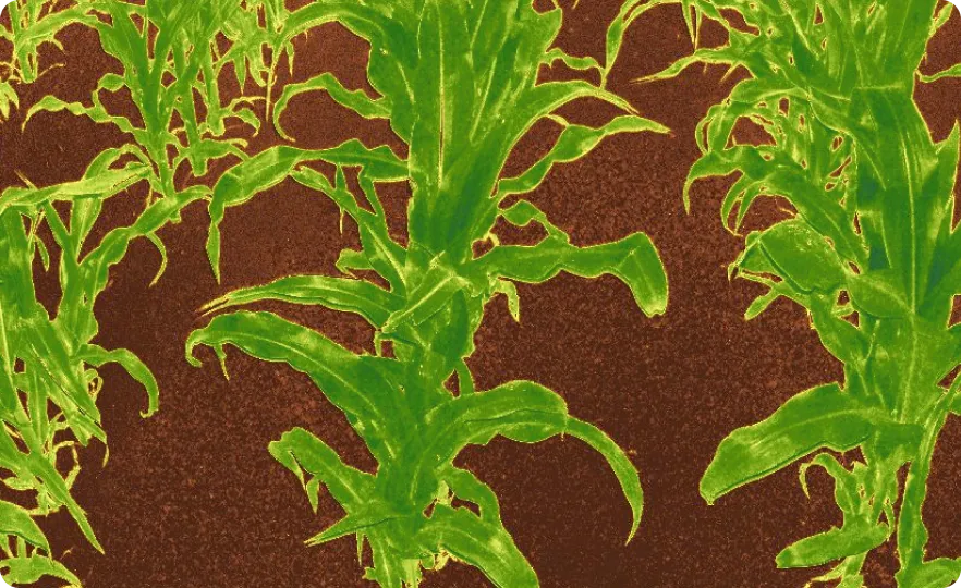
Analyze plant health and growth
Track changes according to the NDVI color coding where blue indicates little to no plant activity and red means high vegetative growth. You can detect weed infestations or uneven crop development.
One place for all your data
Once you set up the mapping and install sensors in your fields, you can analyze NDVI data from agri-cameras and satellite images. Get photos from your fields several times daily and keep up with any changes or anomalies.


Never lose your notepad
Monitor the plant development index of each field and track how crops progress through different growth stages. Get information about phenological stages without the need for scouting.
Optimized fertilization
Plan fertilization schedules more efficiently, ensuring that nutrients are applied at the right time for maximum benefit.

Extensive crop data history
You can always review your planting history and schedule crop rotation correctly. By choosing less susceptible crop families for the new season, you can prevent disease carryover.
Use insights to make improvements
Look through the notes about previous rotations, diseases, and yields to work on increasing the overall productivity of your operations without manual record-keeping.

Crops comparison tool
Evaluate the development and health of different crops across multiple fields. Compare RGB and NDVI photos from your sensors as well as satellite imagery to visualize growth history. Whether you want to predict yield potential or understand which field has better disease resistance, this tool provides the insights you need.
Identify the best conditions
Identify specific conditions that help your crops thrive and adjust your planting strategy and crop health interventions as needed.
Keep your data close
Download all images and data from Cropler’s dashboard at any moment to access it whenever you need it.
Track the key parameters
Monitor and compare the health of your crops, their development features, and environmental conditions 24/7.
Enjoy multiple uses
Whether you need to analyze the effectiveness of fertilizers or compare the development, health, and yields of your new crop varieties, we offer functionality for that.
Want to Look Around?
Get agri-cameras and use the web platform for FREE during the first year
How it works
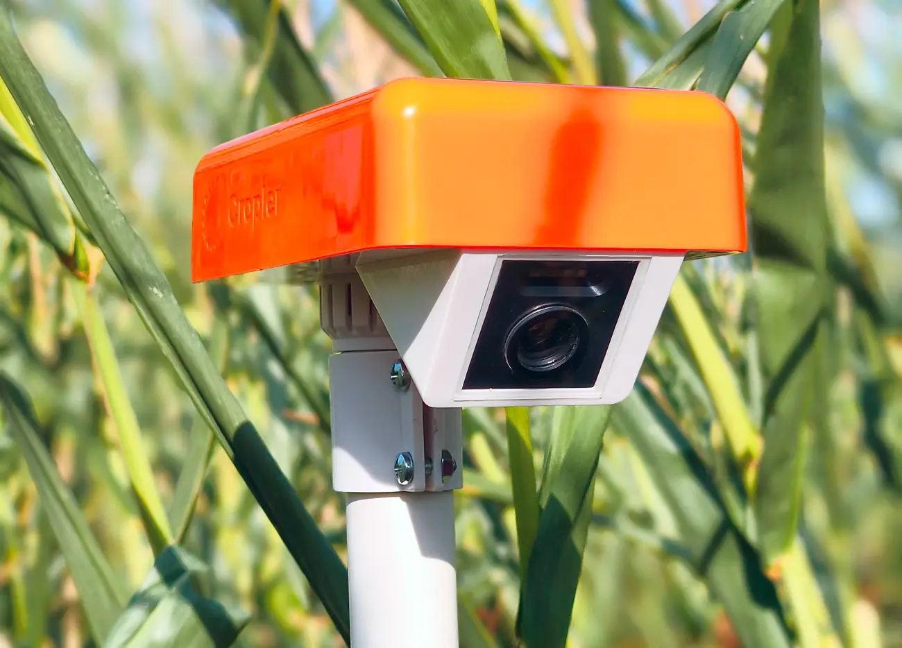
Get agri-cameras
Buy agri-cameras and get free access to the intuitive multiuser web platform for the first year

Install your cameras
Install cameras in the recommended spots to get 24/7 gap-free data about your crops health and key phenophases

Monitor and compare your fields
Access a multiuser web platform with real-time plant photo data, satellite imagery, digital field boundaries, and extensive crop rotation data history

Plan operations efficiently
Take operation-focused field management to the next level with photo monitoring, AI-powered field scoring, and timely notifications

Manage Effort and Resources Rationally with Cropler

Fertilizers’ & seeds distributors
Apply a plant-first approach by using AI-powered photo data to increase your inputs sales by 30%.
Learn More

Agronomists & plant breeders
Gain +20% to the yield quality thanks to timely and consistent harvesting
Learn More
Agroholdings
Enhance profits, logistics, and resource distribution with real-time crop data management
Learn MoreFAQ
Is it possible to use a platform separately from agri-cameras?
Your dashboard presents data received from agri-cameras and humidity sensors, so they should be used together.
Does each camera have a separate dashboard within the web platform?
You have one dashboard with the data from all your cameras. But, each camera requires its own subscription to be added to the web platform.
Is there any way I can monitor the entire field?
Yes. You can view NDVI satellite imagery in association with camera data on our map. We are currently improving our map and will soon have automatic field displays.
I work in a larger organization with different departments. How do we get many people working together?
Our platform supports team management. You can divide access to sensors between different groups of people and set access levels for each person.
We already use a third-party farm management platform and we have all the data in one place. Is it possible to integrate the data into our system?
Yes, you can integrate sensor data into our web platform through our open API. Contact our support team at support@cropler.io for documentation.
Can I leave notes on the data?
Yes. You can comment on photos, leave notes about phenophases or problems, and share them with your colleagues.
I'm not quite sure what dew drop duration means?
This value shows how much dew has fallen on your field during the day. You can also get hourly information about the dew intensity on the graph tab.
